
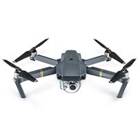
DJI Mavic Pro
Built-in Lens
Ziemes Valley Bridge

@kuhrmarvin
This abandoned railway bridge is in the middle of a gloomy forest and it makes for the perfect location for travelers looking to explore their adventurous side — especially when the fog starts to roll in over the hills, inciting a sense of exciting mystery.
(before flying a drone, check and follow local drone regulations)
Plan
Overview
Skill level
Moderate
Accessbility
Public Location
Hours
Anytime
Fee
Free
Pack
- Drone
- Model
- Bug spray
How to get there
N50° 34' 35.148"E11° 36' 46.7964"
This image was taken with a drone, looking onto the Ziemes Valley Bridge (also known as Ziemestalbrücke). To get here, you'll need a car.
I recommend parking at the trail of Ottergrund (50.582980, 11.613648). From the trailhead, it'll be about a 22-minute walk to the bridge, which is where I launched my drone. Reference the GPS coordinates to see exactly where I stood and then fly your drone up and southwest for this perspective.
Tips
Get more with
explorest pro
Learn more about the locations and
how to get the best pictures including:
Best times to go
Current weather conditions and times around twilight
Field tips
Gear used & photo settings
What to do nearby

Locations nearby


